Jansky Tells of Trip to Wonderland of North; Explains Trails to Take
By Nelson Jansky – Wisconsin State Journal, September 1925

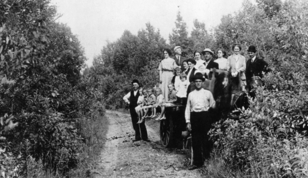
The way up at the “tip of the thumb” on the map of Wisconsin on any Sunday during pleasant weather one can see one of the strangest sights in this Playground of the Middle West. Here, upon a narrow, bumpy road, a mile in length, cut straight through a forest of second growth and occasionally virgin pine, cedar, balsam, spruce and birch, adventurous tourists will find as much traffic as on a fairly lively village street.
Only at intervals is the road wide enough for more than one car, and one will come across autos backing up to find a passing place and tourists abandoning their cars at the few convenient places and continuing along the trail on foot.
The road breaks out of the trees at the extreme point of Door County peninsula, and even those who have grumbled the most at the slow progress of the last mile will be generously rewarded by the panorama before them.
Straight across the bay is Plum Island, above whose tall trees rises the government lighthouse. Beyond Plum Island is Detroit Island and looming big behind the two smaller bodies is Washington Island, the home of Wisconsin’s colony of Icelanders.
This was the scene of one of the most terrible Indian wars in American history. Here, one windy night two great tribes sent their fleets of war canoes against each other, and in the storm and battle, so it is said, every man on both sides perished. Ever since then, the waters between the island and the peninsula have been known as Death’s Door.
At present when the wind is high or a storm approaching, tourists who reach the place can look out into the Door and watch the winds, which sweep in from Green Bay and from Lake Michigan, as they meet in the straits and stir up the water in a furious commotion with cross waves and white caps rushing in apparently every direction. In a storm, the Door is dangerous for any sort of craft. The sight of a hulk of a large Great Lakes freighter lying in the shallow water just off Plum Island suggests that Death’s Door would be an appropriate name for the straits even though Indians had never fought there.
The “tip of the thumb,” or the extreme end of Door County peninsula can be reached with steady driving in a day’s travel from Madison over 230 miles of the finest roads in the state. Only the last mile on the trail, slashed through the forest of evergreens, is one tempted to desert the car for more primitive methods of travel. And although in the middle of the week and during the greater part of the year the road is as deserted as Crusoe’s Island, it will be a surprise to any motorist to notice the size of the procession in the apparent wilderness on any fine Sunday afternoon.
With no railroads, but will-kept gravel highways, the best of camping sites, and, except on weekends, few competing motorists to raise the dust. Door County peninsula is a tourist’s paradise. Wisconsin’s wonderland of lakes and streams in the north central counties has been so widely advertised that, until recently, the “thumb” has been out of the beaten path. Of what comprises the scenery of woods, rocks, and water consists in this region is suggested by the names of inns and hotels, some of which on the western side dub themselves with such names as Sunset Inn, and on the eastern side, Sunrise Resort, and perhaps near some high bluffs, Alpine Resort.
Madisonians who intend to take a short tour before the opening of the schools will find a cement road all the way from Columbus to Green Bay. From Madison to Fond du Lac the shortest route is state trunk highway 31, and route 15 from Fond du Lac to Green Bay by way of Oshkosh. From Green Bay to Sturgeon Bay route 78 is fine gravel all of the way except for short distances out of Green Bay and Sturgeon Bay which are cement. At present there is not a single detour along the whole route.
Sister Bay, the terminal of the state highway system, may be reached by route 78 on the Michigan side, or by route 17 on the Green Bay side. Those who wish to make their stopping place at Sister Bay or farther north will find route 78 a little shorter, smoother, with almost no traffic on weekdays, but with only two contacts with the lake.
Although Sister Bay is the end of the state road, convenient stopping places for excursions to points of scenic beauty to the “tip of the thumb” or to either side of the peninsula will be found at Ellison Bay, at Garret Bay, or at Giles Rock, the landing place of the twice-daily ferry to Washington Island.
Ellison Bay, which is reached by county trunk B, a wide gravel road in excellent condition, is the northern-most village on the peninsula. Tourists looking for home cooking will find that, in the opinion of the writer, the best dinners made outside mother’s kitchen are served at the lodge there.
Ellison Bay is also the home of a large Madison colony. Miss Mary Smith, city librarian, Miss Hester Coddington, Prof. O.L. Kowalke, Prof. L.R. Jones, Prof. J.G. Moore, Prof. E.B. Hart, and Prof. George Wagner all have built cottages there which they visit with their families every season.
Whichever route is taken to reach the end of the peninsula, everyone should at least go one way on the Green Bay side and make the short detour through Peninsula State Park, between Ephraim and Fish Creek. For campers, Peninsula Park offers an ideal stopping place with opportunities to pitch tent on pine needles but a few feet from the water. At Shanty Bay, one of the camp sites, there is a miniature harbor with a sandy swimming beach, shallow water for 200 feet, and an island across the mouth of the bay to protect from the northwest wind.

Peninsula Park is situated in one of the most picturesque districts in the peninsula and contains many hundreds of acres of evergreen timber with numerous trails running through the woods and along the shore. From the top of the forest-fire look-out tower near the Ephraim entrance one can see the northern peninsula of Michigan across Green Bay, and in the opposite direction across Door County Peninsula, Lake Michigan. There is a pine-needle-matted path for three-quarter of a mile through the middle of the park grounds to the lighthouse. From the lighthouse one can see the numerous strawberry islands, the largest of which is Chamber’s Island. In the center of Chamber’s Island is a small toy-like lake and in the center of the lake are two little islands.
Door County has long been celebrated for its cherries, but until recent years it has not been widely known to the tourists for its scenic beauties. It has been visited every summer for some time by such lovers of native landscape as the Madison colony at Ellison Bay, but so far it has been free from the sort of tourist who cuts down trees, pulls up the wild plants, builds fires carelessly, and scatters his rubbish everywhere. Even though there are several resorts and inns along the shores, the native beauty of the place has not yet been marred by commercialism.


